Yes, we survived our first day out on the trail. We loved it so much we planned to hike more the next day! Rosa and I agreed from the beginning that we would definitely average 10 miles during each week to assure that we could complete this trail by the end of the summer. So after our first day, we knew we wanted to go the next day and complete another section. Little did we know that we would fulfill our weekly goal in just the first two days.

Another trail angel, Rosa's husband Mike, agreed to help us this morning by dropping our car off at our end point, and driving us to where we left off yesterday on Route 25. After looking at maps, we decided we could handle walking from here all the way to the Manorville Hills County Park. So, after a quick selfie with Mike, we were on our way! Thank you Mike for being our trail angel today!
We took a look at the map located at the entrance point of today's hike and still cannot believe how far we had come in just one day! As mentioned above, we were looking to do another 8-9 miles and end up in the Manorville Hills park today, which was listed as "the most rigorous portion"" of the trail. The sun was coming up, it was warm, and the most perfect day for more hiking!
We spent the next few hours, following the white blazes, enjoying the signage and landscape around us. It is awesome that we learned how to read these markings, that would otherwise be just random colored blocks painted on trees and land ~ they guide us through forks in the path, as well as trail merges.
I even tried to practice taking selfies with Scarecrow's camera ~ if you have read the blog of his trip, you know he became a selfie expert, as he was hiking alone for most of his travels. His arms are much longer than mine, so he has a major advantage here! I will master my selfies before the end of this trail.
 |
| practicing my selfies |
 |
| just hanging around |
We really made a huge effort to take in our surroundings. Even when they were not so lovely - like the spider webs we walked through, all of the caterpillars hanging in our path, and the thousands of ants scurrying beneath our feet. We came across many tremendous ant hills along the path - we stopped to admire the work of these busy colonies.


It was amazing to see the intricate work being done by so many, moving quickly and orderly, all with a purpose. I am happy we are getting to witness things in nature that we normally would have overlooked or taken for granted. We must have seen like 7-8 ant hills of this size over the course of our walk today.

This portion of the trail was diverse in its landscape. We walked through woods with low lying bushes, grassy field patches, and parts of the path had bushes higher than us and we couldn't see around us!

We crossed over a wooden bridge that was built by an Eagle Scout back in 1993 - there was no water underneath at this time, but lack of rainfall in this dry season was the culprit. We also trekked for a few miles in an area affected by fire. Although it devastated the land at the time, the greenery of regrowth in contrast to the charred trees was amazing.


Although it was a very interesting area to walk through, some of the plants and bushes became quite high. We were walking at some points, not able to see to our sides. This must be where the ticks jumped on for a ride. After arriving home after this day hike, I found 8 ticks who joined me for the journey, while 3 decided to ride with Rosa. We are definitely going to spray ourselves more often as we continue forward in the days and weeks ahead.
Thankfully, all of the caterpillars that we came across did not drop onto us for too long. The leaves of most of the bushes were COVERED in them, with a few occasionally dropping onto our arms for a split second before we would flick them away. There were many that were just hanging in front of us as we walked as well. They were not something we wanted in our faces, so we were very careful to avoid those!

The trail was beautiful, yet uneventful for awhile once we crossed over Schultz Road in Manorville. We were excited to look out and recognize where we were! We were making some serious progress, and still felt strong. We normally walked 3-5 miles daily on the road before this hike, and now we were 5 miles in and feeling like we could walk ALL DAY!
 |
| 5 miles in and feeling fabulous! |
 |
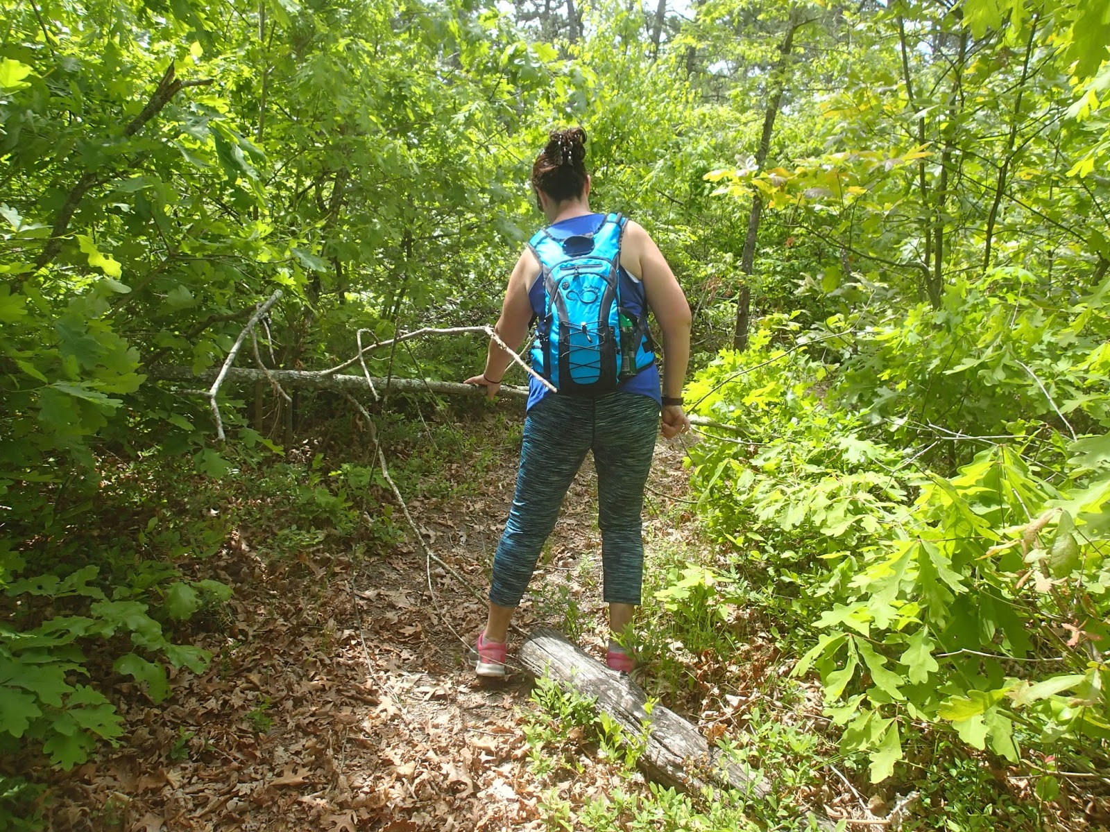
| a few fallen branches didn't slow us down! |


After walking for what seemed like forever through a winding path of some fallen branches, we came across our second bridge of the day, this one crossing over some stagnant water. It was a few steps in from Wading River Manor Road, near the large statue of a bull. Again, we felt excitement for knowing exactly where we were, once emerging from the trail. We had passed this landmark earlier in the morning when Mike had driven us to our beginning point, so it helped us really put into perspective just how far we had come today. Most of this portion of the trail looked very peaceful and inviting, like the picture on the right. We had spotted 6 deer the day prior, and only a chipmunk or two today, so when we came across this interesting character, we had to get a shot of it. After a little Google research, the closest image I could find to resemble this was
Narceus Americanus.

We took our pics, and were on our way. By this time, we were near the Railroad tracks that allow the Greenport line to run. The trail actually heads West a little, allowing us to descend from the 30 feet of elevation above the tracks. We are directed to a road crossing, and after crossing, the trail safely takes us to the other side and back up in elevation.


By this time of day, we were 7 miles in, still feeling strong, and eager to cross over the Long Island Expressway. The path began to get a bit hillier, just South of Mill Road in Manorville. We crossed under the power lines, and back into some pretty deep woods for a while. But, not before another selfie! I see that I definitely need some practice on those.
We continued along, conversing about how cool we were for taking on this journey, proud that not much has phased or startled us, and laughing about how much fun we had when we stopped dead in our tracks. I believe Rosa's exact words were, "Carole, what the F$@K is that?" I look ahead, and sure enough, there is a head on top of a log. It was so creepy.

There were caterpillars by its eye which made it even creepier for us. There were no other clues around the area to assist us in why there was a random plastic head mounted on top of the tree. Again, we took our pics and headed on our way. All this time, we have been following the white blazes, which we will continue to do for the duration of the trail, but we came across new signage that had the Paumanok Path logo on it. This is so much easier to see, and it's cool because we had purchased our shirts to match it.


We weaved in and out of some border fencing, and made it out to Halsey Manor Road, which was a little over 8 miles into our day. We were beginning to feel tired in our legs, but knew we had to keep going to where we parked the car. The trail had us road walk for a little bit, which allowed us to cross over the Long Island Expressway and continue South back into the woods. It was really cool to see the white blazes marked, even on the fence post and railings.


We made a sharp left after crossing the overpass, and submerged ourselves back into the woods, heading towards the Manorville Hills County Park. The hills became steeper, our legs became more tired, and we were now excited to find the parking lot and get to the car. At this point, we were about a mile and a half from the car. We were too busy chatting it up about how far we had walked, when we came across an exit sign. That would have been great news, except the sign was pointing in the direction we had just come from. After consulting our GPS, we realized we had missed the turn for the parking lot and had walked another full mile further than we planned for this day. We back tracked, and found our exit point. Boy, were we relieved to see Rosa's car!
You can see the day's map and progress that we have made.
Another 11.78 miles of the trail complete, totaling 20.83 over two days. And yes, we cannot wait to get back out there next weekend.
Until Next time,
Rosa & The Thruhiker's Wife
 We were able to still see some turtle friends along our path as well.


