Saturday, August 19, 2017

Day #16 on the Paumanok Path...

Another early start ~ we drove and parked my jeep on Napeague Harbor Road and then headed back over to Old Stone Highway to begin our 8 . 5 mile adventure for the day. I must say, we ALWAYS begin our days with a positive attitude and excitement for what we will encounter for the day. But, by the end of this day's hike, we both agreed this was THE WORST SECTION EVER. 

The first 3 miles were beautiful. The trail was wide, well marked, and very scenic. Bugs were at a minimum, and we were moving right along.  At just about 3 miles in, the trail brought us out to Cross Highway, and we could not find a blaze that would continue our trail. After looking at GPS, and taking a short detour down a side road, we decided to continue on down Cross Highway, and eventually, we came upon another blaze. Thankful for the validation, we continued on. Even as we approached our fourth mile, things were good.  A turtle sighting always brightens our day.


 We entered into Napeague State Park, and the next 3 miles were a nightmare.  The trail was swarming with mosquitoes, and we were walking through thick sand for most of the way.  When we stopped to reapply spray for the mosquitoes, we looked down at our legs and saw that we were covered in ticks. Not even the large ones that you can easily see and remove. There were what felt like hundreds of tiny, brown ticks EVERYWHERE. We brushed off as many as we could, sprayed, and brushed off some more before picking up our pace and moving as quickly as possible through the rest of the park.  There was not much to see other than pine trees, sand, mosquitoes and ticks. It was at that moment that we knew... this was the WORST part of our experience to date.

At the east end of the park, we exited out onto Napeague Meadow Road for a few minutes of a reprieve with a bit of road walking.  We had to turn onto a dirt road which led us past the Victor D'Amico Institute of Art, and then into some beach grass with not much of a trail to follow, down to the shore of Napeague Harbor.


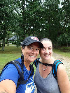
This area was very nice, and although there were no blazes to be seen anywhere, we knew we were supposed to be here. The shore line was covered in dead horseshoe crabs, with most of them being tiny babies.  We were happy to be out of the woods for a bit, and the breeze coming off of the water was nice.  There was not a break in the mosquitoes, however, as you can see in the picture. One was still biting me on my forehead as we took this picture.


 We finished up the rest of this section along a private dirt road that allowed access to the homes in the area. This private road exits out onto Napeague Harbor Road, right where my jeep was waiting for us.  We were happy to be done for the day, as the skies then opened, and it poured the whole drive home. You can check out our latest progress on the map below.  Only 2 hiking days until the finish line!

 Until Next Time,

Rosa & The Thruhiker's Wife


Monday, August 14, 2017

Day #15 on the Paumanok Path...

Another early wake up for us today! We left for the trail by 5:40 am, and were walking out by 7 am. We have found this helps us maintain a much better time schedule, due to the distance we now have to drive to even start.  We have determined that including today, there are 4 more days of hiking until we reach the finish line at the Montauk Lighthouse. We are getting very excited to finish up this great achievement we set out to do back in June.

So our hike began on Northwest Road, and brought us immediately into some interesting history. Along with the remains of a well and a foundation from a home, there were stones that marked the foundation of an old school house that housed 30-40 students and the teacher!


The logs you see in the picture were placed along the existing foundation corners to show just how small this school house was. We were fascinated with these areas of history and all of the information that is researched and posted for us to learn from. What a great start to our day!


Some of my photos seem random, like this leaf that looks like a crab claw, but we are mostly in woods, surrounded by brown pine needles and fallen leaves, and plenty of green leaves still on the brush and trees.  So, when a pop of color shows up, it is quite prominent to us, and I feel it deserves its own picture. I think I enjoy finding these random pops of color throughout our walks.
side of the road selfie

We began today's hike thinking we were walking about 9 . 5 miles. The first three miles went very quickly, as we were walking through mostly woods, in what is listed as Northwest Harbor on the map.  We crossed over a few roads, but for the most part, were in the woods.

We wound around the trail and came up on the longest foot bridge we have had to cross thus far.  Most of the little ones we cross were amazing projects completed by eagle scouts, that help walk over muddy areas, or very little streams in the woods. Today, we walked over a lengthy bridge that crossed a pretty extensive stream (the largest one we've come across yet).


 After crossing this marshy area, we came into an area of tall skinny trees, which looked cool, but the trail is not as pronounced in these types of woods and you rely on the blazes to guide you.  Because the trees are so skinny, it sometimes becomes difficult to locate the blazes. So you definitely have to pay attention through here.
a view from our day 
We came across a few turtles again today. This has become one of my favorite parts of hiking. Because I was able to snap a picture face on with a turtle before, I am trying to have all the turtles I see, pose for a selfie. Some are more cooperative than others.


This guy was really small and skittish.  I try very hard not to disturb their travels, but am very excited to have them be a part of our daily experience.


The next one we came across was struggling to climb up the mossy ledge. It was the perfect angle for me to grab a shot before moving along.


The last one we saw hung out and didn't seem too shy as I tried to get close up for his shot. I started reading a little information about these beautiful creatures, and found a very informative website HERE.

One really important thing I learned is how important it is to not to take a box turtle from where you found it, as they never wander far from where they were born.  According to the WEBSITE,  A common trait that many box turtles share is a deep connection to the location they were born in. Most specimens do not travel far from the place of their birth. One of the leading causes in the decline of box turtles is humans taking them from their homes and then re-releasing them elsewhere in the wild. Box turtles who experience this will often wander aimlessly, trying to find their original home until they die.


We usually see plenty of deer in our travels, usually trotting away because we have startled them by walking. Today, we were lucky to grab these photos, as the deer were just as curious as we were. Several times, the deer just stood and watched as we slowly walked on the trail.

another pop of color
We both agreed that this section was absolutely beautiful. One of our favorites to walk through.  This section of the trail ended up being 11.3 miles, instead of the 9 . 5 that we had thought, but we made it to the end.

You can check out our latest progress on the map below. When totaling up the mileage of each hike we have taken, the distance is just under 98 miles.  We will hit the 100 mile mark when we continue the hike this week.  With about 27 miles left, we are excited for the end!


Until Next Time,
Rosa & The Thruhiker's Wife


Friday, August 11, 2017

Day #14 on the Paumanok Path...

What were we thinking? A 5:30 a.m. to meet up and drive to the trail?! BUT WE DID JUST THAT! What a great decision. We were already with cars in their places for drop off an pick up, and on the trail by 7:00 a.m. We began the 6 mile hike, which coincided with the Northwest Path Trail, on the East Hampton - Sag Harbor Turnpike, just south of Edwards Hole Road. The three yellow triangles notate the beginning of the Northwest Path, but I immediately thought of The Legends of Zelda and the triforce!

the TRIFORCE is present
What a beautiful section of the trail. The path was wide, well marked and filled with sounds of birds chirping, and there were plenty of deer... all of which we startled into bolting away from us.


A little over a mile into the hike, we crossed over Two Holes Water Road, and came across the beautiful view of Two Holes Pond. The water was like glass, boasting a clear, perfect reflection of the tree line.
 
We wandered around and behind some absolutely beautiful homes and crossed over Bull Path at around the 2 . 5 mile mark.  I wonder if the people living around here know about the trails that completely encompass their properties. For not only the beauty around them, but so they are aware that we are not random trespassers!


We crossed over the intersection of Northwest Road and Old Northwest Road, and were back in the woods for the duration of the trail. We came across an old well, but, we also greeted with an informational sign explaining why and how it was in the middle of these woods.


We definitely love coming across the signs and information provided in these trails ~ we never knew how much history we could learn from this hike.  There was nothing but beautiful woods to look at. The pictures do not do justice to the serenity of these woods.


 Many times, because we are walking first thing in the morning, many things, including spider webs are undisturbed when we arrive near them.  Unfortunately, whoever is leading the way, which is Rosa most of the time, may get some of these webs in their face as we walk along the trail.  Thankfully, today, this spider decided to create his beautiful web off the path, so we were able to enjoy it as we walked by.


Other than the mosquitoes being an absolute nightmare, our day was filled with beauty, tons of laughter and a sense of accomplishment. Getting out of the house by 5:30 this morning, completing 6 miles, and being ready to tackle the next 8+ miles this Sunday, has left us on a high note.

sunny day selfie
beauty is everywhere


You can check out our latest progress on the map below. We have estimated that we have about 4 hiking days left until we reach our destination on Montauk. We are very excited.


Until Next Time,

Rosa & The Thruhiker's Wife

Day #13 on the Paumanok Path

We set out this morning excited to know exactly where to park our cars. Sometimes, due to lack of information available, we estimate where would be appropriate to end the next hiking day, and have been lucky so far.  We began on the Bridgehampton-Sag Harbor Turnpike, just south of where Carroll Street meets up with the turnpike. If you weren't looking for the signs specifically, you may miss them, as they are on the post at the end of someone's driveway.


They day was overcast, but we were okay with it, as we didn't want to be in the rain again this week.

Long Pond
 There was not much to report during the first 2 . 5 miles, other than walking the entire length of Long Pond, and thankfully not being bothered by mosquitoes. Usually, we will know immediately if we are approaching any time of water, because the buzzing is in our ears, they are landing all over us, and we are swatting while walking.  Today, they were not too intrusive.

We crossed over Sagg Road, and at the 3 . 5 mile mark, crossed over Town Line Road. We were in the woods for a little bit more, before crossing Wainscott NW Road before finishing up the rest of the trail in the woods.
photo by Carole Warren


I decided to just group these few pictures at the end, and should caption them as: "random/cool things we come across while hiking" because although we have seen plenty of these glacial erratics, they continue to surprise me as they pop up out of the middle of nowhere every time.


And as for the perfectly cut circle with sticks and branches set up as if there was a bonfire happening, well... that's pretty random. We can only imagine what is going on out here in these woods.  We made it to my jeep, which was parked in a little lot on the East Hampton-Sag Harbor turnpike, just a few miles south of Swamp Road. This is a very easy to find, helpful spot for anyone planning out this hike.

another successful day complete!
 
You can check out our progress on the map below.
Until Next Time,
Rosa & The Thruhiker's Wife


Sunday, August 6, 2017

Day #12 on the Paumanok Path...

Although the forecast was calling for rain all day, Rosa and I decided to continue on the trail today. We felt really good about our progress, and wanted to keep the momentum going.  We decided to head out even earlier this morning because the drive to get to the trail is now an hour away! We left by 6:30, and were on the trail by 7:38.

We parked on Middle Line Highway, right near the Paumanok Path sign, and were on our way. We were hoping the rain would hold off until we at least got started into the woods, and our prayers were answered. It remained overcast until about 15 minutes into our hike and then remained raining steady for the duration of our walk.


About a half mile into our walk, we came across this interesting, almost perfectly circular pond, with an equally circular formation of lily pads in the center. According to Google maps, I believe it is named Camps Pond. It was a really beautiful little area to begin our day. We were able to enjoy the smooth look of the water surface before the rain began.


Still south of Middle Line Highway, the next mile and a half had us winding around patches of twisted trees and crossing over Noyac Path before making our way north to cross back over Middle Line Highway.  We walked behind and around some absolutely beautiful houses, walking up upon some pretty random things, like a skull and bones of an animal, to random structures, that seemed to be no where near anyone's home to be utilized.


We came upon plenty of deer today, startling them way before I could get any pictures of them.


At about two and a half miles in, we were directed out onto Millstone Road for about a half mile, until the trail brought us back into the woods and had us walking north. The trail was very slippery by this time, as the leaves and branches were soaked by the rain that was steadily coming down.  Thankfully, neither of us were bothered by it, and welcomed the coolness that it brought.


The trail become extremely hilly at this point as well.  We would ascend, slowly, and need to take a second's breath at the top before continuing.  We got quite a workout today! About 4 miles in, we came across a path that would take us to Trout Pond Park. From the maps, it looked like it would be 1+ miles off of the Paumanok Path, so we admired the sign posted, and continued on our way.

It would be another 2 . 5 miles before we would cross another paved road, but we were kept busy by all of the turtles we came across in our path.


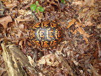


 photo by Carole Warren
Five to be exact! Each with such a beautiful pattern on their shell, and each so very different from each other. Some retracted immediately into their shell, yet others just stood, head still out, waiting for us to pass.  We tried to move past them quickly, as to not disturb or frighten them.  The last one we saw, however, was either ready for his close up or ready to battle, as he just stood there, glaring at the camera, not budging at all.  We got our picture, and went on our way, thankful for all that we saw today.


 We had just passed the 6 mile mark, and crossed over Stony Hill Road. We had decided that we would call Mike for our ride home, knowing we would reach our exit point in a little over a mile.
The homestretch to our endpoint, to our shelter from the pouring rain, to our seats and a hot meal.  We were happy to be finishing up today.

I came across this fallen tree, which when it fell, snapped into what I saw was the letters N Y.


This section of trail had a huge cluster of glacial erratics.


This last stretch of woods would take us out to the Bridgehampton-Sag Harbor Turnpike, and would have allowed us to complete 7. 6 miles of the trail.  We were very happy with how much progress we have made.  We were even more excited when we immediately located the blaze and Paumanok Path sign to direct us where we would be beginning next time.


 You can check out our progress on the map below.


Until next time,

Rosa & The Thruhiker's Wife